Four fatalities reported in Boone and Marion tornado
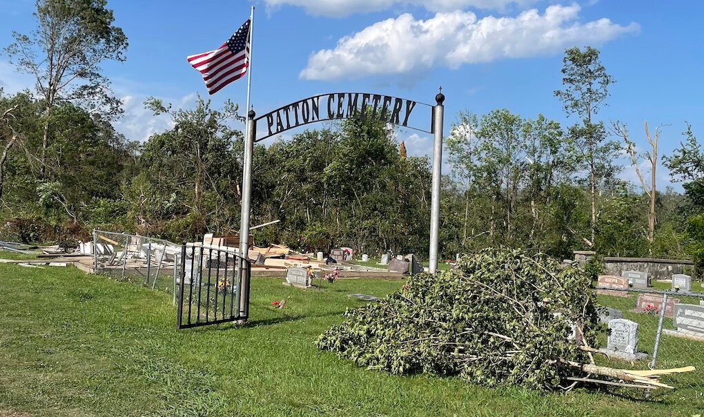
Destroyed pavilion at Patton Cemetery near Pyatt in Marion County
Jeff Dezort/Staff
Posted
NWS Little Rock
Our damage survey crew found evidence of an EF-3 tornado beginning in Boone County, continuing into Marion County from early Sunday morning storms. At 21 miles long, 1500 yards wide, packing winds up to 145 mph this was an incredibly intense tornado. National Weather Service finishes survey of damage in Boone, Marion counties, confirms EF3 tornado
National Weather Service Little Rock AR
911 PM CDT Mon May 27 2024
Start Date: 05/26/2024
Start Time: 03:27 AM CDT
Start Location: 2 S Bellefonte / Boone County / AR
Start Lat/Lon: 36.177 / -93.048
End Date: 05/26/2024
End Time: 04:04 AM CDT
End Location: 2 NNW Summit / Marion County / AR
End Lat/Lon: 36.277 / -92.699
Survey Summary:
This tornado started just to the west of Bellefonte road, near
the intersection of Maxie Camp Road in Boone County, damaging
trees and a few power poles as it crossed the road. A few homes
sustained some damage, mainly to the their roofs and the southern
and southeastern exterior walls. A hay barn was also completely
destroyed. The tornado then kept moving east into an open field,
snapping trees in it`s path and along Maxie Camp Road. The
tornado crossed US highway 65, moving over the Boone County
Sheriff`s Department Building and an Arkansas State Police Troop
Center. The two buildings sustained very minor damage, mainly
consisting of missing shingles and bent light poles. A loaded
trailer of the BCSD was likely lofted and tossed onto a gate on
the premises that sustained major damage to become inoperable.
Just east of the highway, a storage unit complex sustained damage
to all three storage buildings, and an RV was flipped on it`s
side. Another business building behind the storage units only
sustained damage to glass windows and a broken garage door. Just
to the south of the storage complex, another large metal building
with multiple bay doors facing the prevailing tornado forward
speed winds was badly damaged, with most walls collapsed.The
tornado kept moving east, likely expanding in width, and snapping
trees and power poles along Maxie Camp road. As the tornado
approached the intersection or Maxie Camp and Starkey Road, a
mobile home was completely lofted and rolled, and destroyed.
Extensive tree damage was observed all along the north south
portion of Maxie Camp Road. A few homes, one with with CMU
footprint and the other with a partial concrete pad and open
crawlspace concrete footing were completely lifted off of their
bases and destroyed. No anchoring was found on the homes and poor
construction was observed from the damage. Trees in the immediate
vicinity of the destroyed homes were completely snubbed as well.
Despite the poor construction qualities and poor anchoring, the
catastrophic damage was consistent with low-end EF3 windspeeds of
140 mph. A resident of one of the destroyed homes sustained non-
life threatening injuries.The tornado began to move northeast,
paralleling US highway 62, moving just southeast of Olvey, and
causing mainly tree damage and damaging small outbuildings. BCSD
reported one fatality in Boone County inside a destroyed mobile
home, near the Olvey area.The tornado then crossed into Marion
County, continuing to follow US highway 62 to the south, near
Pyatt. Marion County EM reported 3 fatalities from this tornado.
Extensive tree damage was observed across several county roads,
and a few mobile homes were tossed and destroyed on county road
4010. The tornado then began to move up the Crooked Creek valley
where extensive tree damage was observed, and moderate damage to
the second level of a tin home was found as well. The tornado
kept moving northeast, damaging or snapping most trees in it`s
path as it crossed Crooked Creek and county road 4006 and the
Snow Access Road and Snow Campground. The tornado then crossed US
highway 62 again near the municipality of Snow, causing minor to
moderate damage to a few homes around the area. As the tornado
crossed US highway 62, it began moving northeast again, causing
mainly tree damage to the north of the highway, and eventually
crossed state highway 125 north, and county road 3032, where more
extensive tree damage was observed, and another mobile home,
which was untethered, was lofted and completely destroyed. The
tornado continued to move east-northeast, mostly causing tree
damage, before dissipating to the northwest of Summit.